If you are planning to visit the land of “The Fatherland’s Headland” – Ha Giang, do not miss the following places to eat and play!
Ma Pi Leng
also known as Ma Pi Leng, Ma Pi Leng (meaning “horse’s nose”) is known as the king of passes in the Northwest mountains, a dangerous pass about 20km long, located in Pa Vi and Pai Lung communes, Meo Vac district and Ta Lung commune, Dong Van district.

Ma Pi Leng Peak is located at an altitude of 1,200m in Dong Van Stone Plateau on the road named Happiness connecting Ha Giang city with Dong Van and Meo Vac districts. From the top of Ma Pi Leng, visitors can admire the panoramic view of Dong Van Stone Plateau. The majestic mountain scenery with a steep cliff on one side and a deep abyss of Nho Que River with emerald green water on the other side. Visitors can come to Ma Pi Leng from January to March because this is the time of flower seasons such as plum, peach, mustard flowers, April attracts with the Khau Vai love market, September is attractive with the ripe rice season in Hoang Su Phi or November and December are the season of buckwheat flowers.
Ma Pi Leng is unique, rugged but beautiful, worth conquering for visitors on the journey to the beautiful land of Ha Giang.
Border markers
Ha Giang has many border markers from marker 172 to marker 517. Many border markers are easy to visit, and there are many beautiful landscapes around.
From the intersection of the border of the three countries Vietnam – Laos – China (also known as marker 0, A Pa Chai) on the top of Khoan La San mountain (Ta Mieu, Sin Thau commune, Muong Nhe district, Dien Bien) to the east, through Dien Bien and Lao Cai provinces, marker 172 is the first border marker, next to marker 172 is Pa Vay Su Border Control Station.

The last border marker of Ha Giang is 519/2 in Tra Man village, Son Vi commune (Meo Vac district), bordering Duc Hanh commune (Bao Lam district, Cao Bang). On the other side of the border is Suoi Lung village (Bach Do village, Na Po district, Guangxi, China). From the center of Son Vi commune, drive about 10 km by motorbike to reach Tra Man village, where border markers 519, 519/1, 519/2 border with Cao Bang.
The two border posts of Son Vi (Ha Giang) and Coc Pang (Cao Bang) regularly organize joint patrols, combining clearing the road to clear the border line from marker 519 to marker 520. During the patrols, the two units exchanged information and assessed the situation. Thereby, helping the two units maintain and strictly manage the border, landmarks, and social order and safety between the two localities.
Quan Ba Heaven Gate
Located at an altitude of 1500m above sea level. From here you can admire the entire beautiful Northwest mountain and forest landscape.
Ha Giang has long been famous as a land that preserves valuable historical relics and cultural beauty of 22 ethnic groups in the Northern Highlands, along with many scenic spots that make the whole world admire, such as Lung Cu Flagpole, Ma Pi Leng Pass, Quan Ba Twin Mountains, Dong Van Karst Plateau Global Geopark…

Among them, the most famous is Quan Ba Heaven Gate – a place that seems to bring visitors to the high horizon, so that they can step up to the clouds in one step, which is sought after by many travel enthusiasts and has not yet “cooled down”.
Dong Van Stone Plateau
This is a stone plateau area that stretches across 4 districts of Ha Giang. This place was recognized by UNESCO as a Global Geopark since 2010. Located at an altitude of 1000 – 1600m above sea level, Dong Van plateau has important significance for the development of the ancient Earth.

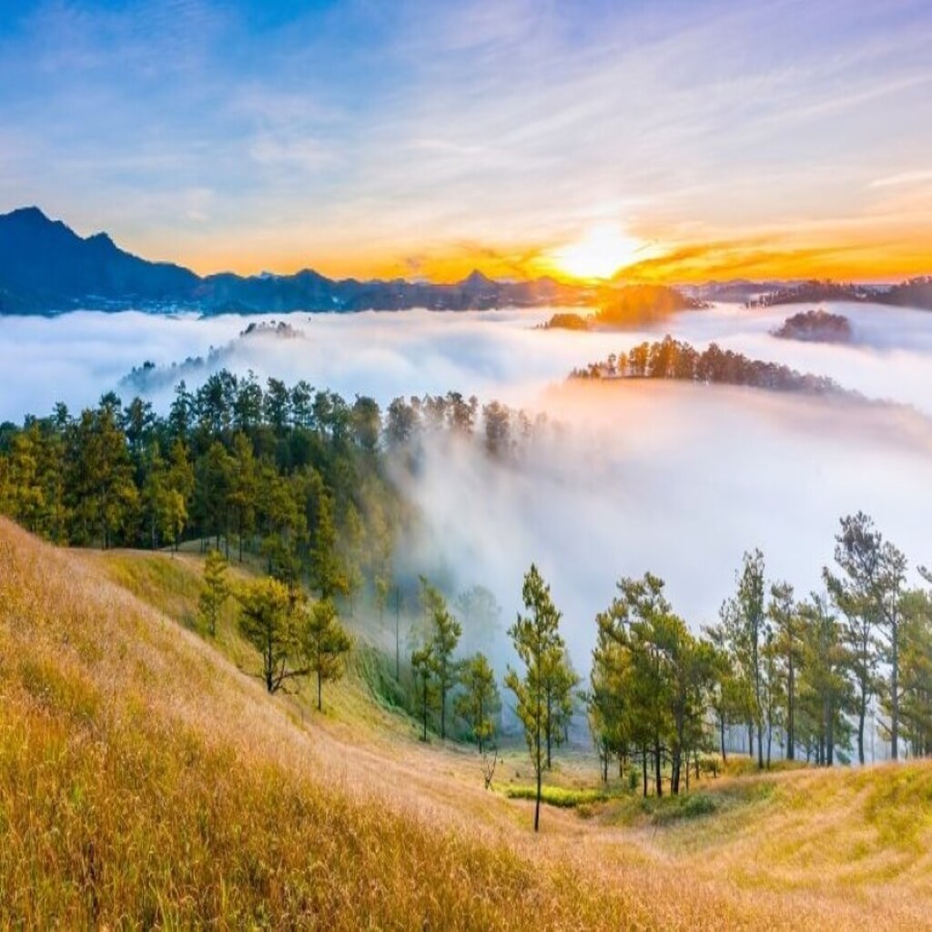
Yen Minh pine forest
Possessing extremely poetic scenery with rows of cool green trees reaching to the sky. The pine forest brings a sense of peace, relaxation and fresh air.

Yen Minh pine forest nestles, covering a corner of Ha Giang sky with green. About 100km from Ha Giang city to the Northeast, following National Highway 4C Can Ty through 3 communes of Bach Dich, Na Khe and Lao Va Chai, you can reach Yen Minh pine forest. Just arriving at Na Khe, tourists on a Ha Giang tour from Ha Noi can immerse themselves in a land dominated by pine trees. There are rows of straight green pine trees, smooth green needles, pine tops reaching up to the blue sky,… everywhere is the vast green of pine forests. Through many storms and tempests, the rows of pine trees are still standing tall and straight, protecting the people here.
0 Comment